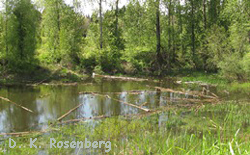
 Both the western pond turtle (Actinemys marmorata) and the western painted turtle (Chrysemys picta bellii) are considered priority conservation species in Oregon. Conservation of native turtles in Oregon is motivated by strong public participation, including turtle conservation working groups, and actions on the ground by many land management agencies and non-profit organizations, including the Oregon Zoo. Conservation of turtles is one of the key Species at Risk that the Oregon Wildlife Institute focuses on for research, education, and conservation planning. OWI has developed conservation plans for native turtles from Eugene to Portland.
Thornton Lake Turtle Conservation Plan
Thornton Lake, an old channel of the Willamette River near downtown Albany, is one of the few places in the mid-Willamette Valley where western pond turtles and western painted turtles coexist. The Lake is mostly surrounded by private homes, except for a 27 acre property recently acquired by the City of Albany. This property, known as the East Thornton Lake Natural Area will be saved as a quiet place for exploring nature in a growing, urban neighborhood.
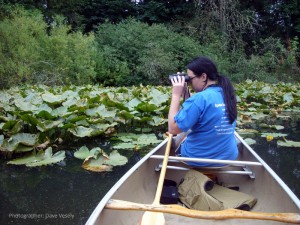 OWI is assisting the City of Albany in developing a conservation plan for the native turtles of Thornton Lake. The project involves turtle surveys, a habitat assessment, and an analysis of factors limiting turtle populations at the site. The project is aided by a number of homeowners who are allowing OWI access to their properties and volunteering to record turtle observations.
Fieldwork at Thornton Lake began in July 2012. The final management plan will be completed in the summer of 2014.
Sponsors: City of Albany Parks & Recreation Department, ODFW Conservation Strategy Implementation Grant
Portland (Columbia Slough) Turtle Conservation Plan
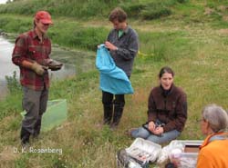 The Columbia Slough watershed is a key area for conservation of turtles in Portland, and includes Portland’s Smith and Bybee Wetlands Natural Area.
The extensive aquatic resources support significant turtle populations in Portland. At the same time, the urban environment poses many challenges for short- and long-term conservation of these species. The goal of this conservation plan is to create a blueprint for actions for conservation of native turtles in Portland, and specifically to inform management, education, research, and monitoring actions related to turtle conservation. In Portland, turtles live in diverse habitats from small ditches to large lake systems. In the Conservation Plan, we recommended adaptive management (“learn by doing”) to evaluate what we believe are two key limiting factors to turtle distribution and abundance in the Columbia Slough watershed: (1) rarity of deep pools, and (2) proximity of habitat for hatchlings (brood habitat) and nest habitat to aquatic foraging habitat. Fortunately, work by the Columbia Slough Watershed Council and others is already underway in evaluating water depth profiles with an eye to work with others to improve conditions for turtles.
The Plan provides a suite of suggested projects for improving conditions for native turtles that would involve numerous agency partnerships, including Metro, City of Portland’s Bureau of Environmental Services, Port of Portland, Oregon Department of Fish and Wildlife, and most importantly, Multnomah County Drainage District, which has jurisdiction of most of the aquatic habitat in which turtles live in the Columbia Slough watershed.
Sponsors: Oregon Wildlife Heritage Foundation, Oregon Zoo, City of Portland, Metro, Port of Portland, Oregon Department of Fish and Wildlife
Newton Creek Wetlands
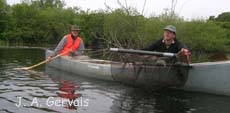 OWI collaborated with a team of natural resource specialists to prepare a conservation plan for the Newton Creek Wetlands Complex in Benton County, Oregon. The plan addressed site-specific factors limiting populations of rare plant and animals and developed prescriptions for management of native prairies, Oregon white oak woodlands, and wetlands that occur on the site.
OWI conducted a pilot study on the movements of western pond turtles in Newton Creek wetlands during spring and summer of 2007. Twenty‐six turtles were trapped and permanently marked with a unique identifier for long‐term population monitoring. Nine turtles (6 females, 3 males) had small radio transmitters glued to their carapaces to permit us to investigate a new method of finding turtle nests using both radio telemetry and detector dogs. Based on turtle activities and habitat conditions we observed during the study, we were able to map two locations that are highly probably turtle nesting areas.
Sponsors: Marys Peak Natural Resources Interpretive Center, Marys River Watershed Council.
West Eugene Wetlands Conservation Plan
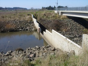 The West Eugene Wetlands (WEW) is among the largest areas of wetland prairie remaining in the Willamette Valley. However the site is surrounded by expanding residential and commercial developments that threaten to isolate WEW animal and plant populations. We used more that 200 observation records of western pond turtles collected by volunteers to map concentrations of turtle activity. Fieldwork during 2008 was performed to classify habitats, locate blocked stream passages, and identify road segments likely to be hazardous to overland movements by turtles. This information was compiled into a geographic information system (GIS) to facilitate an analysis of factors limiting the WEW western pond turtle population. Our work was also intended to help restoration managers locate habitat improvement projects in areas most likely to be used by turtles
and away from areas where vehicle traffic and other human activities cause turtles to be at risk.
Sponsors: Bureau of Land Management, Eugene District